Adapting to Sea Level Rise
Climate Change + Climate Adaptation
In California, climate change impacts include the loss of Sierra snowpack, increasing and increasingly intense wildfires, extreme heat events, and sea level rise. These impacts affect our health, economic well-being, ecological resilience, and the places we call home. Addressing climate change is a defining challenge of our time. We address climate change in two primary ways: taking action to reduce greenhouse gas emissions, and taking action to adapt to the changing environment. We need to do both. When it comes to adaptation, Marin County has analyzed vulnerability to sea level rise and has published guides for local governments and others to identify tools for adapting to it. With our General Plan Update, Tiburon needs to choose the set of tools that will work here.
Understanding Sea Level Rise
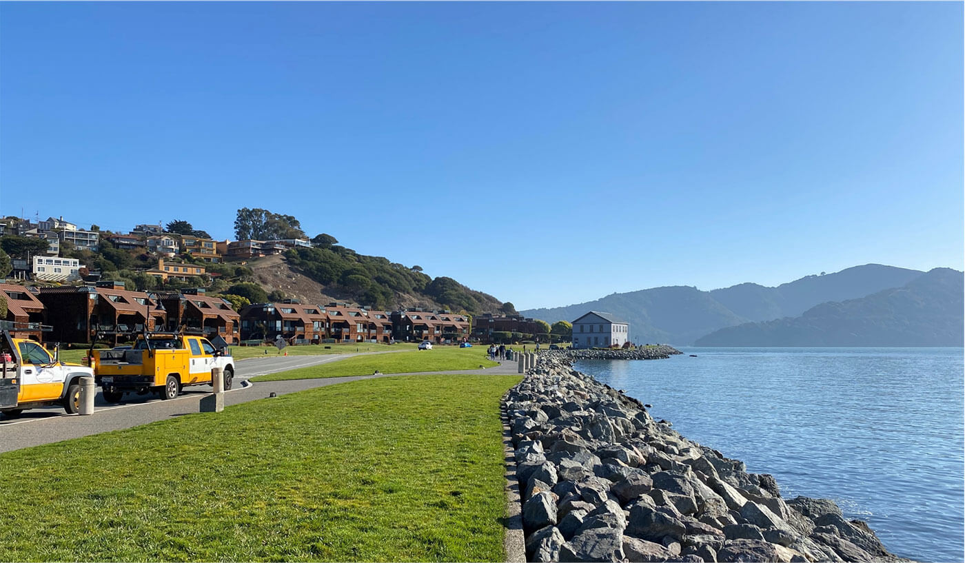
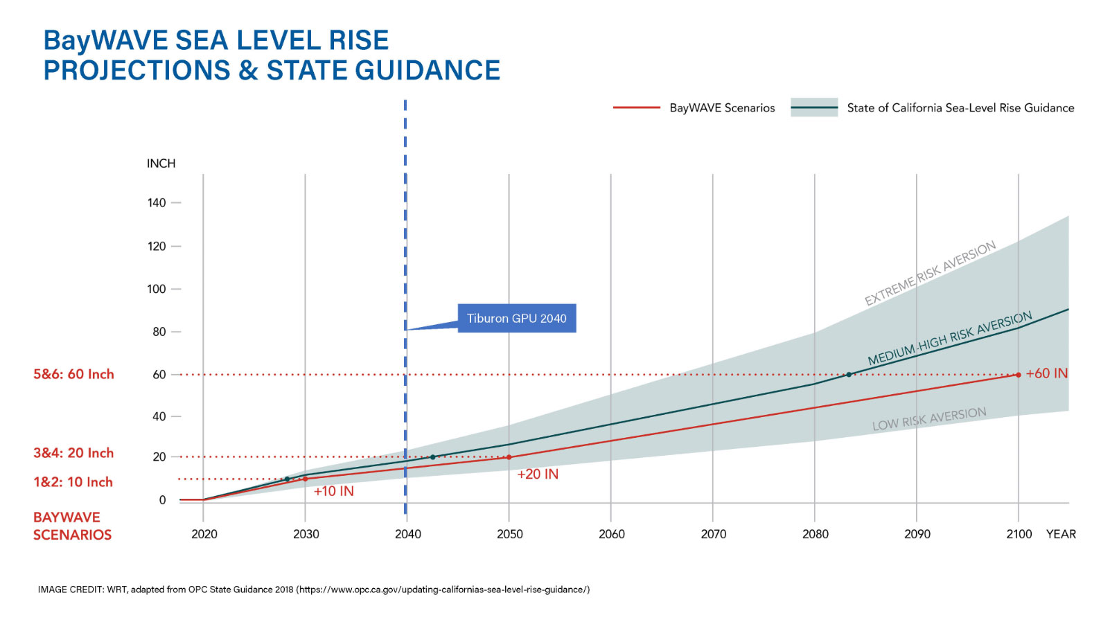
We know that parts of downtown Tiburon experience flooding today during major storms. What will things be like as sea levels rise? A set of projections calculated for Marin County, known as BayWAVE, show sea level rise scenarios at 10, 20, and 60 inches, and estimate where regular inundation would occur as well as what would be vulnerable in 100-year flood events. It is likely that sea level rise between 10 and 25 inches by 2040, the end of our current planning period, and by 60 inches or more by end of century. Sea level rise also interacts with stormwater, groundwater, and liquefaction in ways that we’re still learning about.
What’s Vulnerable in Tiburon?
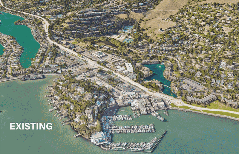
According to Marin County’s analysis, some 341 housing units, 2.4 miles of roads, 135 acres of land, and over $400 million in assessed value are at risk, as are marsh and beach ecologies. While sea level rise will be an issue all along our shoreline, the areas of greatest vulnerability within the Town limits are Downtown, the Blackie’s Pasture area, and the Greenwood Cove area. Buildings and businesses along Main Street may be the most vulnerable to direct sea level inundation in the near term. Tiburon Boulevard downtown is likely to become more vulnerable to flooding as well.
Adaptation Choices
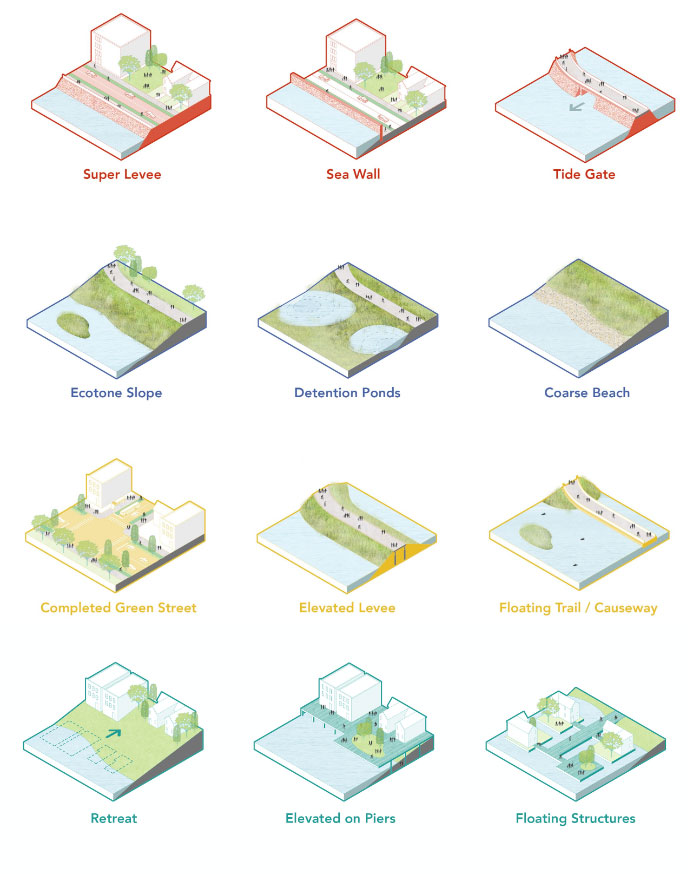
Adapting our environment to sea level rise will require ingenuity, resources, and collaboration. This section describes some of the strategies we can use, alone or in combination.
• Shoreline Hardening. This set of strategies refers to traditional infrastructure like flood walls and bulkheads, riprap-armored shorelines, levees and dikes, breakwaters, jetties and groins.
• Nature-based Strategies. These approaches may create beaches, dunes, or vegetation communities that naturally counteract sea level rise impacts or restore drainage patterns that allow sediment to settle in nearshore areas.
• Adapting Transportation. Redesigning roads with green infrastructure to detain and clean stormwater runoff, elevating roadways on levees, realigning highways, and creating trail causeways.
• Adapting Development. Elevating buildings, designing new buildings to flood; and creating incentives and requirements to shift development out of harm’s way.
How do we choose the right strategies for the right place?
We need to think clearly about our values and priorities. Do we want to protect existing development in its current form, accommodate more frequent flooding, or shift away from vulnerable areas entirely? How long should our strategy last? Who is mostly responsible—the general public, individual property owners, or a combination? How much are we willing to invest?
Second, we should think about how adaptation might also support other public benefits, like creating new public access opportunities, restoring ecological functions, protecting a vital transportation asset, or preserving community character.
We invite you to help us decide how to best adapt Tiburon to the future.